The Authoritative Truth Layer For African Agriculture
Satellite-powered verification infrastructure that prevents fraud, ensures transparency, and delivers accountability. Designed for African governments and development institutions managing agricultural programs at scale.
AU Agenda 2063
African Union Development
CAADP Malabo
Agriculture Development
SDG 2
Zero Hunger Goal
World Bank ESF
Environmental & Social
ISO 27001 Ready
Information Security
AU Agenda 2063
African Union Development
CAADP Malabo
Agriculture Development
SDG 2
Zero Hunger Goal
World Bank ESF
Environmental & Social
ISO 27001 Ready
Information Security
Multi Billion Dollar Fraud Crisis in African Agricultural Subsidies
African governments invest Billions of dollars annually in agricultural subsidies. Yet the absence of cost-effective verification infrastructure enables systematic fraud that undermines program effectiveness, erodes public trust, and prevents millions of legitimate farmers from receiving support.
Cost Per Farm (Manual Verification)
Traditional field verification is financially prohibitive at scale, forcing governments to verify only 5-10% of beneficiaries through sampling. This leaves 90-95% of program participants unverified, creating massive opportunities for fraud.
Standard Fraud Rate
Agricultural subsidy fraud remains a persistent challenge across developing nations. From ghost farmers to inflated claims and duplicate registrations, these issues have disrupted programs worth hundreds of millions — all while legitimate farmers are deprived of the critical support and interventions they are in dire need of.
Verification Delay
By the time manual verification results arrive, the agricultural season has often passed, preventing corrective action. Field enumerator corruption further compromises data integrity through collusion with beneficiaries.
Traditional M&E Sample Coverage
Baseline surveys, midline assessments, and endline evaluations provide valuable insights but cost 10-15% of program budgets while covering only 1-5% of beneficiaries. Self-reported data has 30-40% over-reporting rates.
Why Satellite Verification Now?
The convergence of technology maturation, policy momentum, donor requirements, and political pressure creates an unprecedented opportunity for transformation.
Technology Maturation
Sentinel-2 satellites provide free 10-meter resolution imagery every 5 days globally. Cloud-based processing platforms democratize planetary-scale analysis. Machine learning achieves operational accuracy thresholds for deployment.
Policy Momentum
AU Digital Transformation Strategy (2020-2030) prioritizes agricultural digitization. CAADP Malabo Declaration mandates transparency and accountability. National digital agriculture strategies require technology adoption.
Donor Requirements
World Bank increasingly requires satellite-based M&E for agricultural projects. AfDB digital agriculture strategies mandate technology integration. Bilateral agencies prioritize results-based financing with verification.
The Meridian Sentinel Solution
Satellite-powered verification infrastructure built on proven enterprise platforms. Designed specifically for African agricultural systems and institutional requirements, delivering 100% beneficiary coverage at Up to 80% lower cost than manual methods.
Independent
Objective satellite data eliminates enumerator corruption and collusion. Tamper-proof verification results that governments can defend.
100% Coverage
Verify every single beneficiary at a fraction of manual cost. Process 100,000+ farms in under 24 hours with consistent methodology.
Real-Time
Monitor crop health every 5 days throughout the growing season. Receive automated alerts for drought stress, pest outbreaks, and crop failure.
Auditable
Complete methodology documentation. Ground truth validation. Results that satisfy parliamentary oversight and donor due diligence.
The Sentinel Six : End-to-End Agricultural Verification
End-to-end verification capabilities built on satellite remote sensing with scientifically validated methodology. Designed specifically for African agricultural systems and institutional requirements.
Farm Boundary Detection
Confirms farm existence, validates declared sizes against satellite measurements, detects ghost farmers, and flags discrepancies for field investigation. Processes large-scale programs efficiently.
Crop Type Classification
Identifies crop types across African agricultural systems including maize, cassava, sorghum, rice, millet, yams, and groundnuts. Detects intercropping patterns common in smallholder systems.
Crop Health Monitoring
Tracks vegetation indices throughout the growing season. Provides early warning for drought stress, pest outbreaks, and crop failure. Enables targeted extension services.
Yield Prediction
Predicts farm-level and aggregated yields pre-harvest. Informs food security planning, import strategies, and price stabilization policies based on satellite-derived indicators.
Planting/Harvest Dates
Automatically detects planting and harvest dates through vegetation pattern analysis. Verifies compliance with program timing requirements and tracks phenological shifts.
Rangeland Management
Estimates forage biomass, calculates grazing capacity, classifies drought severity, and maps water point availability. Critical for pastoral early warning systems.
Satellite-Powered Program Integrity
Achieve 100% Beneficiary Verification and Automated Fraud Intelligence for Global Aid.
Universal Program Coverage
Verify every single beneficiary in your agricultural program using satellite imagery updated every 5 days. Move beyond statistical sampling to 100% verification coverage—ensuring no ghost farmer goes undetected and every legitimate farmer receives their entitled support.
Automated Fraud Intelligence
Advanced machine learning models analyze field boundaries, vegetation patterns, and crop development to automatically flag ghost farms, area inflation, and misreported crops. Surface high-risk cases for investigation within 48 hours while auto-verifying legitimate beneficiaries—freeing your team to focus on program delivery.
Development-Grade Documentation
Generate comprehensive verification reports meeting World Bank, AfDB, and international donor standards. Every assessment includes satellite imagery evidence, geospatial accuracy metrics, and audit trails—providing the documentation development institutions require for program approval and disbursement.
Rapid Deployment: Operational in 4 Weeks
Streamlined implementation process from contract signature to full operational capability. Proven methodology with clear milestones and deliverables.
WEEK 1
Data Upload
Beneficiary list with GPS coordinates uploaded and validated. Data quality checks and formatting standardization.
WEEK 2
Satellite Analysis
Satellite imagery processing, machine learning classification, boundary detection, and quality assurance.
WEEK 3
Verification Results
Fraud detection reports generated, dashboard access provided, stakeholder training conducted.
WEEK 4
Continuous Monitoring
Health tracking activated, automated alerts configured, continuous monitoring operational.
Partner with Agrovue to Transform African Agriculture
Ready to Eliminate Fraud and Transform Your Agricultural Programs?
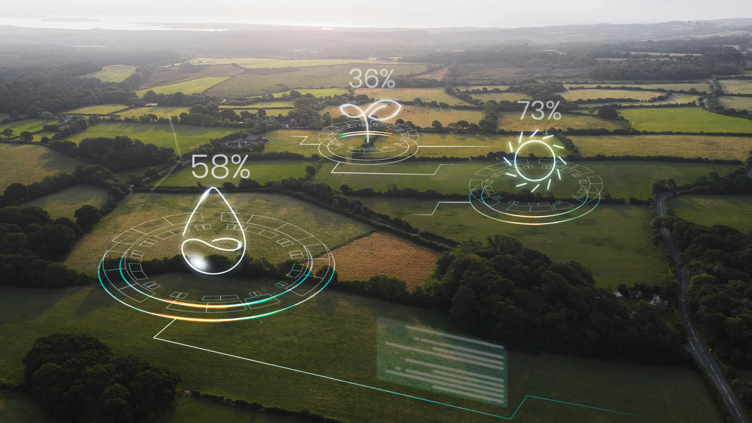
Real-Time Satellite Monitoring
Track agricultural activities across vast landscapes with continuous satellite surveillance and automated change detection.
Multi-Spectral Imaging
Capture data across visible and infrared spectrums to assess crop health, soil moisture, and vegetation indices.
Continuous Coverage
Daily satellite passes ensure you never miss critical changes in your monitored areas.
Automated Alerts
Receive instant notifications when significant changes are detected in your areas of interest.
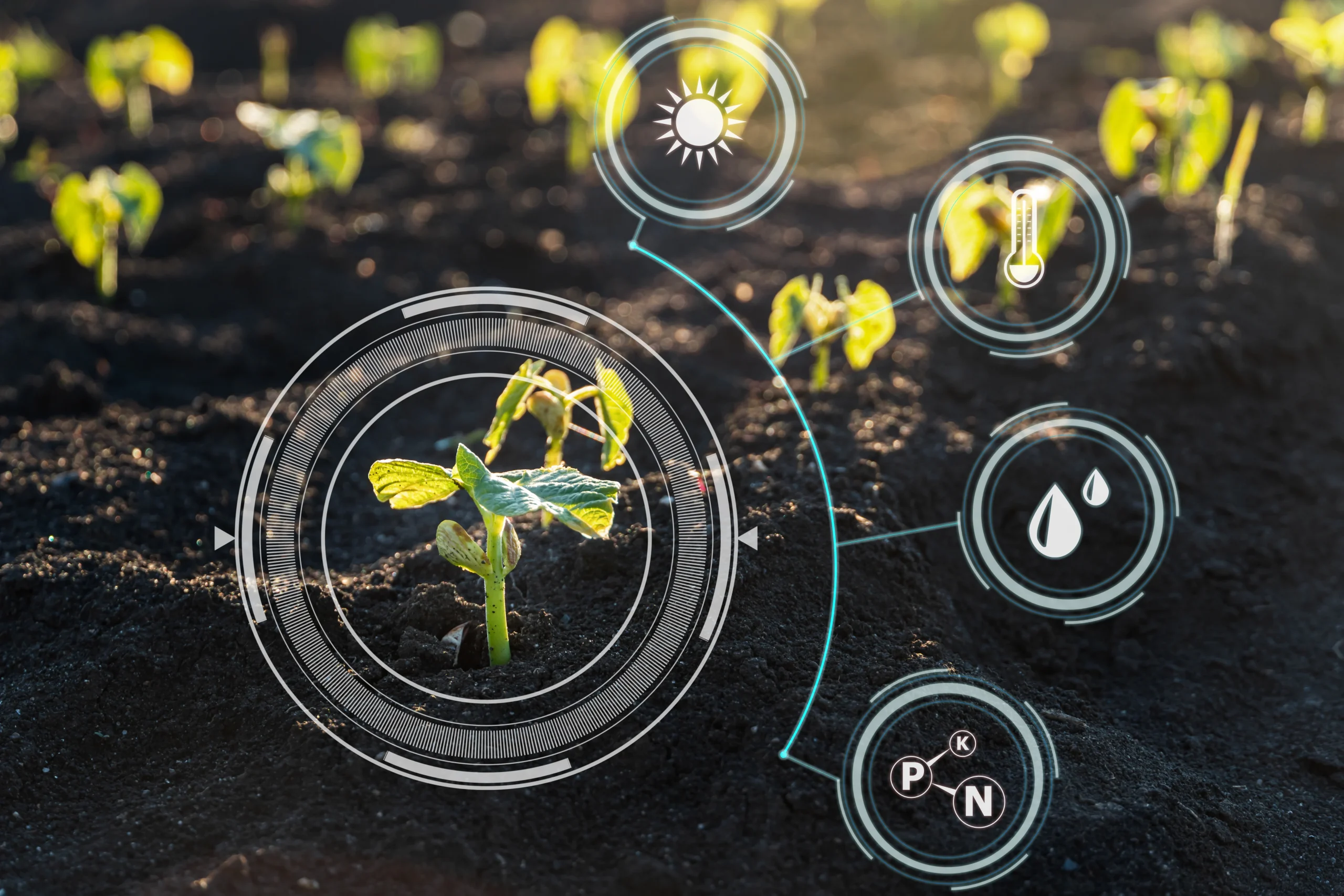
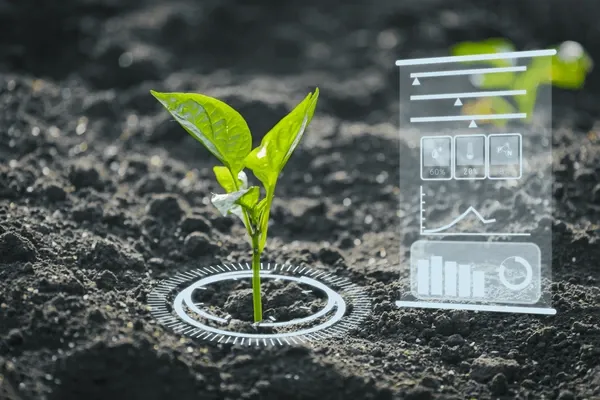
AI-Powered Crop Intelligence
Transform raw satellite data into actionable agricultural insights using advanced machine learning algorithms.
Deep Learning Models
State-of-the-art neural networks trained on millions of agricultural data points for accurate crop classification.
Yield Prediction
Forecast crop yields weeks before harvest with High-accuracy Validated models using historical and real-time data.
Health Assessment
Detect crop stress, disease, and nutrient deficiencies before they become visible to the human eye.
Data-Driven Decision Making
Access comprehensive dashboards and reports that turn complex satellite data into clear, actionable recommendations.
Interactive Dashboards
Visualize trends, patterns, and anomalies across your entire agricultural portfolio in real-time.
Automated Reporting
Generate compliance-ready reports for stakeholders, auditors, and regulatory bodies with one click.
Data Export
Export raw data and analytics in multiple formats for integration with your existing systems.
Precision Agriculture at Scale
Optimize resource allocation and maximize yields with field-level precision across thousands of hectares.
Variable Rate Mapping
Create prescription maps for targeted application of water, fertilizer, and pesticides based on actual field conditions.
Water Management
Optimize irrigation schedules using soil moisture data and weather forecasts to reduce water waste by up to 40%.
Input Optimization
Reduce fertilizer and pesticide costs by 20-30% while maintaining or improving yields through precise application.
Aligned with Global Development Frameworks
Meridian Sentinel directly supports implementation of major agricultural development frameworks and institutional mandates across Africa.
African Union Agenda 2063
Goal 5: Modern agriculture for increased productivity and food security. Digital Transformation Strategy (2020–2030): Agricultural digitization priority. Supports continental agricultural development vision.
CAADP Malabo Declaration
Commitment 3: Ending hunger (yield forecasting supports food security). Commitment 7: Accountability for actions and results (transparent verification). CAADP M&E Framework alignment.
Sustainable Development Goals
SDG 2.3: Double smallholder productivity and incomes (verified input programs). SDG 2.4: Sustainable food production systems. SDG 16.5: Substantially reduce corruption (prevents fraud).
World Bank & AFDB Standards
World Bank ESF: Environmental and Social Standards M&E component. Results-Based Financing: Independent verification of disbursement-linked indicators. AFDB Agricultural Transformation Strategy.
Where Verification is Needed
Major ongoing African agricultural development programs where independent verification infrastructure would prevent fraud and ensure transparency. These represent the target market for satellite-powered monitoring and evaluation.
Tanzania ARIGP
National Agricultural and Rural Inclusive Growth Project targeting 500,000 smallholder farmers with productivity enhancement and market access initiatives.
Nigeria APPEALS
Agricultural Productivity Enhancement Project across 8 states focused on rice, cassava, and horticulture value chains covering 100,000 farmers.
Ethiopia AGP
Agricultural Growth Program II targeting 2 million farmers with focus on wheat, teff, maize, and pulses. Requires comprehensive impact evaluation.
Ghana METASIP
Medium-Term Agriculture Sector Investment Plan including Planting for Food and Jobs program (1M+ farmers). Post-fraud scandal requiring credible verification.
Kenya NAAIAP
National Accelerated Agricultural Inputs Access Program supporting smallholder farmers with improved seeds and fertilizers across multiple counties.
Uganda Feed the Future
Focus on maize, beans, coffee, and horticulture targeting 500,000 farmers. Requires rigorous impact evaluation.
Your Data. Your Control. Your Sovereignty.
Complete data ownership with flexible deployment options to meet institutional requirements and data sovereignty needs.
100% Government Ownership
Government owns all data—beneficiary lists, GPS coordinates, verification results. Meridian Sentinel is a processor, not an owner. Data never sold, commercialized, or shared with third parties.
Deployment Flexibility
Standard cloud deployment, Africa-hosted option (AWS Cape Town where data never leaves continent), or complete on-premise deployment in government data center. Choose what fits your requirements.
Enterprise Security
AES-256 encryption, TLS 1.3, role-based access control, multi-factor authentication, immutable audit logs. Compliant with international data protection standards.
Industries We Serve
We help a wide range of industries and businesses drive innovation, sustainability and efficiency.
Policy Compliance & Verification
(CAP, LPIS, IACS)Support evidence-based policy implementation through continuous CAP compliance monitoring.
- Crop-type mapping for compliance checks
- Automated parcel verification and control
- Yield analysis for policy performance monitoring
- Detection of land-use change and eligibility verification
Agriculture
Meridian Sentinel helps agricultural players increase efficiency, reduce costs, and make data-driven decisions.
- Precision field mapping and management zones
- Crop identification and seasonal monitoring
- Precision spraying and planting
- Farm digitalization and advisory tools
- Yield forecasting and performance benchmarking
Insurance
Meridian Sentinel delivers high-resolution, satellite-based intelligence to reduce costs, delays, and uncertainty.
- Automated parcel identification during claims
- Crop-type and yield verification for policy validation
- Damage detection after extreme weather events
- Portfolio risk monitoring across regions
Compliance
(Global Monitoring & Verification)Ensure transparency and traceability with AI-powered global monitoring and field-level verification at scale.
- Land-use change and deforestation monitoring
- Verification of crop origin and sourcing compliance
- Traceability and reporting for sustainability standards
- Continuous monitoring of regenerative practices
- Ship and vessel activity detection
Partner with Meridian Africa
Schedule a consultation to discuss how satellite verification infrastructure can transform your agricultural programs, prevent fraud, and maximize impacts.
Partner with Agrovue to Transform African Agriculture
Ready to Eliminate Fraud and Transform Your Agricultural Programs?