
Tailored for Every Agricultural Stakeholder
Beyond government programs, Meridian Sentinel provides specialized solutions for the entire agriculture ecosystem.

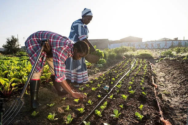
Maximize Program Impact with Transparent Monitoring
Ensure donor funds reach intended beneficiaries, track program implementation in real-time, and demonstrate measurable impact with objective satellite-based evidence.
- Verify beneficiary eligibility without costly field visits
- Monitor subsidy program project outcomes
- Quantitative impact relief with real-time crop damage assessment
- Generate impact reports with satellite/weather satellite evidence
- Scale monitoring to 100x more farms/hectares for same budget

De-Risk Agricultural Lending with Satellite Intelligence
Make informed credit decisions using satellite-based risk assessment. Monitor borrower farm performance throughout the loan cycle and enable data-driven interventions at scale.
- Verify farmer claims (land ownership, farm size, crop type) before credit award
- Monitor crop health and predict yields for early default warnings
- Enable index insurance with automated satellite-based payouts
- Reduce loan processing time from weeks to 48 hours
- Cut verification costs by 80%, making smallholder lending profitable
Manage Member Farms with Data-Driven Insights
Track individual member performance, optimize collective operations, and provide members with satellite-derived crop performance data.
- Monitor all member farms simultaneously (no instead visits required)
- Identify underperforming farms for targeted extension support
- Aggregate production forecasts for better buyer negotiations
- Detect crop stress early for intervention recommendations
- Generate proof of production for contract farming compliance

Ensure Supply Chain Transparency & Traceability
Verify supplier claims, monitor contract farming compliance, and meet sustainability requirements with satellite-verified field-level data.
- Verify farmer operations are production capacity
- Monitor contract farmer compliance (crop type, timing, practices)
- Demonstrate for sustainability (EUDR compliance)
- Forecast supply volumes for logistics planning
- Generate traceability reports for buyers (quality)

Enable Scalable Crop Insurance with Satellite Verification
Reduce field verification costs by 80%, enable index insurance at scale, and process claims in 24-48 hours vs weeks of field investigations.
- Automate verification (drought, flood, crop failure) using satellite data
- Process claims in 5-48 hours vs weeks of field investigations
- Detect fraudulent claims (e.g., claiming damage on non-existent fields)
- Enable parametric insurance with objective satellite triggers
- Drastically reduce verification cost

Accelerate Agricultural Research with Continental-Scale Data
Access the largest dataset of smallholder farm performance across Africa for climate research, breeding, and policy research.
- Access continental database (millions of farms)
- Multi-year crop performance time series
- Climate-crop interaction data (drought, heat, flood)
- API access for model training and validation
- Co-publication opportunities with Meridian Sentinel team